The Gold Lake Highway is a 15.5 mile 2 lane road located on the northern end of the Sierra Nevadas between Highway 49 and Sierra City on the south end to Highway 89 and Graeagle on the north end. This region provides a treasure trove of outdoor recreational activities such as fishing, hiking, mountain biking, road cycling, on and off-road motorcycling, OHV/Jeep trails, camping and swimming.
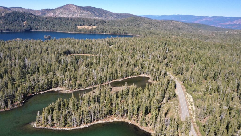
With all of the outdoor opportunities in the area you can explore here endlessly, whether it’s a quick day trip or a long weekend camping excursion. Most of the campgrounds in the area give you direct access to the recreational activity you are looking for which makes it easy and fun. Gold Lake, for example, is an easy entry point to get to the Deer Lake Trail for a day of off-roading adventure.
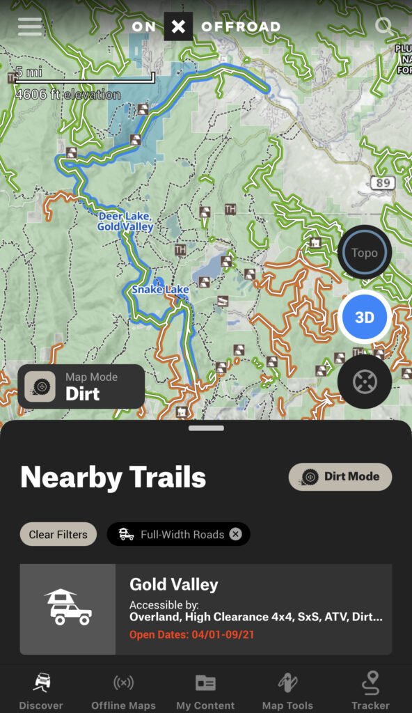
If you don’t yet have it, I strongly recommend getting the On X Off-road app. It’s a great app that gives you detailed info on most places that you might want to go off-road. You can create your own tracks with it, explore trails and add photos along the way. Most importantly, you can download maps before you go. A lot of the areas here don’t have cell service so you can’t rely on something like Google maps to take you into the backcountry. With On X you can download a selected area with all of the details so that it is accessible throughout your trip.
On X also allows you to create waypoints the same way you would with a GPS, making it easy to get back to where you started. If you get the app I also recommend spending some time with it before you go so that you are familiar with it. Getting lost in the backcountry with an app that you aren’t familiar with is no way to have fun! If you are completely new to backcountry travel then I also highly recommend taking a class on navigation, at the least, before you go.
Camping – Several of the many lakes here offer National Forest campgrounds with somewhat limited amenities such as water and vault toilets, picnic tables and fire rings. Campgrounds generally open in May and stay open through October depending on the seasonal snowfall.
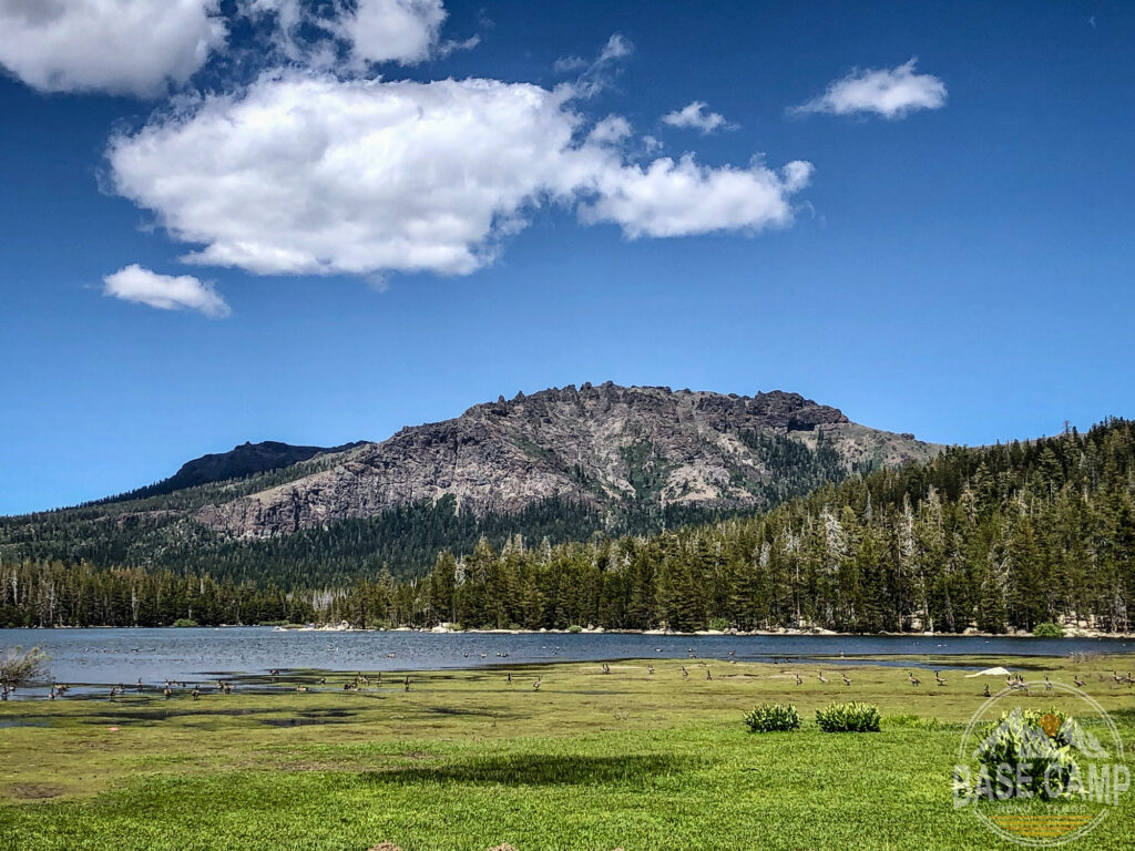
Always check to see what’s open before you head out. Also, even if you go during the summer, check the weather first! Gold Lake sits at an elevation of 6400′ so the nights can get chilly and mountain storms can roll through unexpectedly. Be prepared!
Gold Lake is one of the larger campgrounds in the area and includes 37 campsites as well as a boat launch facility. The road from the main highway is narrow and drops down to the lake where you will see several different camping areas. As you get close to the campground you will first come to the OHV trailhead on the left. There is also a parking lot in this area for day hikers. Continuing along the entry road you will see the first camping area down on your left and then another up to the right. Past that is the paved boat launch area and then entrance to the next camping area. You will see a narrow and rough first road which goes along the shore of the lake and has several lake view designated camping spots. It does get tight along the road so I would not recommend an RV. A smaller trailer or Sprinter van may fit in some of the spaces but I would scout it first to make sure that you are comfortable getting back there.
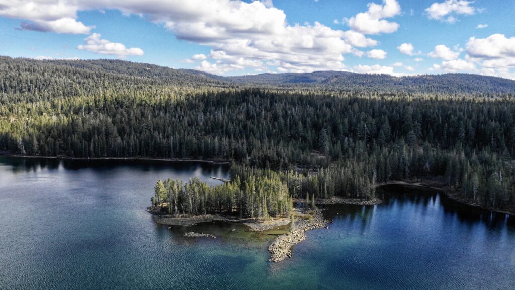
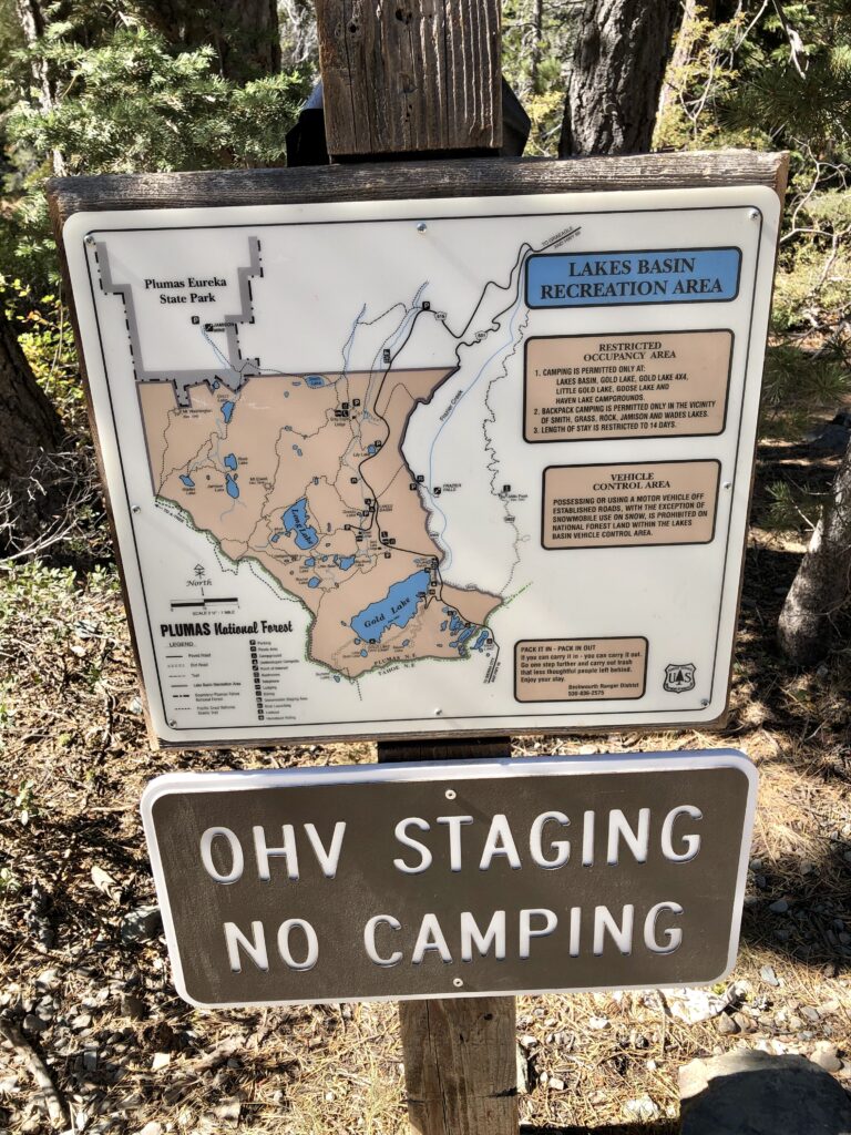
Gold Lake Highway is also home to the Lakes Basin Recreation Area. This area surrounds Gold Lake, runs north from the lake and is part of both the Plumas National Forest and the Beckwourth Ranger District. It offers outdoor recreation such as backpacking, hiking, swimming, fishing, boating, camping, mountain biking and trails for motorized fun like motorcycles, Jeeps and sideXsides.
For more information on this area you can check out and print this National Forest Service page here.
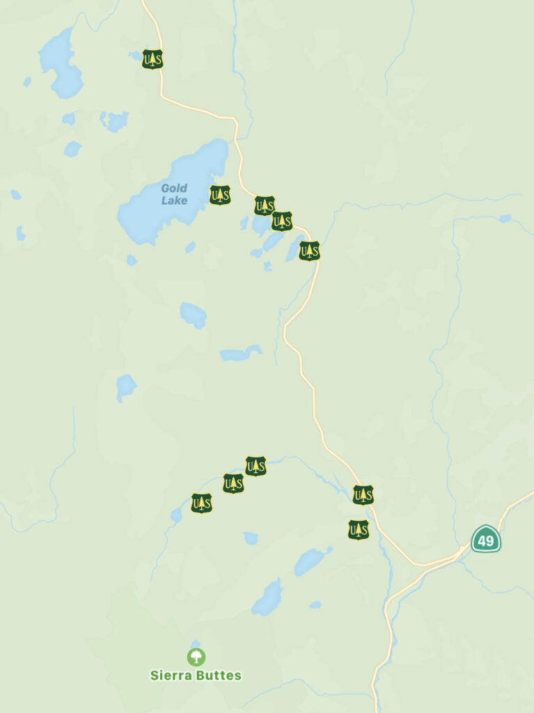
Also, the Backcountry Discovery Trail is a great way to see the surrounding areas. Suitable to SUV’s and high clearance vehicles, the BDT takes you through the mountains and past geological wonders as well as old cabins, ghost towns and more. The trail is also broken up into different sections so that you can pick just one section to do on a weekend if you don’t have time for a longer trip. As always, check forest and fire restrictions before you head out!
A map of the Backcountry Discovery Trail can be downloaded here.
| Type | RV and tent camping |
| Roads | Mountainous drive in on Hwy 49 from the south or a flatter drive in on Hwy 89 from the north. |
| Elevation | Roughly 6500′ |
| Environment | Wooded, mountains and lake |
| Kid Friendly | Yes |
| Dog Friendly | Yes, with leash. Trails and swimming. |
| Family Friendly | Yes! |
| Activities | Hiking, equestrian camping and trails, motorcycle trails, mountain biking. Dirt roads for street licensed UTV’s and Jeeps. Swimming and fishing at the lake. Lots of exploring to do. |
| Cell Service | No signal at most of the lakes. |
| Closest Services | Graeagle, Sierra City, Sierraville, Quincy or Portola |
| Facilities | Picnic tables, fire rings, water. |
| Hookups | None |
| Reservations | Book as early as possible! recreation.gov |
| Contact | https://www.fs.usda.gov/detail/htnf/alerts-notices/?cid=fseprd573315 |
Resources
- Plumas National Forest – All things about the forest including camping, trails, special features and OHV accessibility.
- Beckwourth Ranger District – Includes areas south and east of Gold lake.
- Bear Safety – Be bear aware! If you haven’t had to recreate with bears before then read this before you head out.
- Campfire Permits – If you are NOT going to be in a developed campground then you must have a permit for a campfire.